


WILLOWICK CITY 3A Voting District, Lake County, Ohio
About
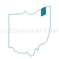
Outline

Summary
| Unique Area Identifier | 648280 |
| Name | WILLOWICK CITY 3A Voting District |
| County | Lake County |
| State | Ohio |
| Area (square miles) | 0.11 |
| Land Area (square miles) | 0.11 |
| Water Area (square miles) | 0.00 |
| % of Land Area | 100.00 |
| % of Water Area | 0.00 |
| Latitude of the Internal Point | 41.63099720 |
| Longtitude of the Internal Point | -81.48556240 |
Maps


Graphs
Select a template below for downloading or customizing gragh for WILLOWICK CITY 3A Voting District, Lake County, Ohio


Neighbors
Neighoring Voting District (by Name) Neighboring Voting District on the Map
- Voting District 007999, Cuyahoga County, OH
- Voting District EUCLID-02- I, Cuyahoga County, OH
- Water, Lake County, OH
- WILLOWICK CITY 3B Voting District, Lake County, OH
- WILLOWICK CITY 3C Voting District, Lake County, OH
- WILLOWICK CITY 3D Voting District, Lake County, OH
- WILLOWICK CITY 3F Voting District, Lake County, OH
Top 10 Neighboring County Subdivision (by Population) Neighboring County Subdivision on the Map
- Euclid city, Cuyahoga County, OH (48,920)
- Willowick city, Lake County, OH (14,171)
- County subdivisions not defined, Lake County, OH (0)
Top 10 Neighboring Place (by Population) Neighboring Place on the Map
Top 10 Neighboring Unified School District (by Population) Neighboring Unified School District on the Map
- Willoughby-Eastlake City School District, OH (65,407)
- Euclid City School District, OH (48,923)
- School District Not Defined (Water), OH (4)
Top 10 Neighboring State Legislative District Lower Chamber (by Population) Neighboring State Legislative District Lower Chamber on the Map
- State House District 62, OH (111,790)
- State House District 7, OH (102,553)
- State House Districts not defined, OH (0)
Top 10 Neighboring State Legislative District Upper Chamber (by Population) Neighboring State Legislative District Upper Chamber on the Map
- State Senate District 18, OH (345,273)
- State Senate District 25, OH (306,356)
- State Senate Districts not defined, OH (0)
Top 10 Neighboring 111th Congressional District (by Population) Neighboring 111th Congressional District on the Map
Top 10 Neighboring Census Tract (by Population) Neighboring Census Tract on the Map
- Census Tract 1523.02, Cuyahoga County, OH (4,238)
- Census Tract 2005, Lake County, OH (3,036)
- Census Tract 1523.01, Cuyahoga County, OH (2,718)
- Census Tract 2001, Lake County, OH (1,831)
- Census Tract 9900, Lake County, OH (0)